
The Starting Point (Cloud)
Recently, BNIM and a team of collaborators* began work on the renovation of Kansas State University’s Seaton Hall, home of the school’s architecture department. When an architecture firm begins work on an architecture school, it’s a daunting task to be sure. Unlike other projects, these schools represent the future of our own profession and bring back memories of our education. The building an architect learns within inevitably has an effect on them as they progress towards, and later join, the world of architects. It is, after all, the home of many late nights, some all-nighters; there are even days you don’t step outside that building’s walls. Beyond that, we — faculty, staff, students and design community — are our own worst critics. Which is why we have to begin at the right starting point — or, in our case, a lot of right points.
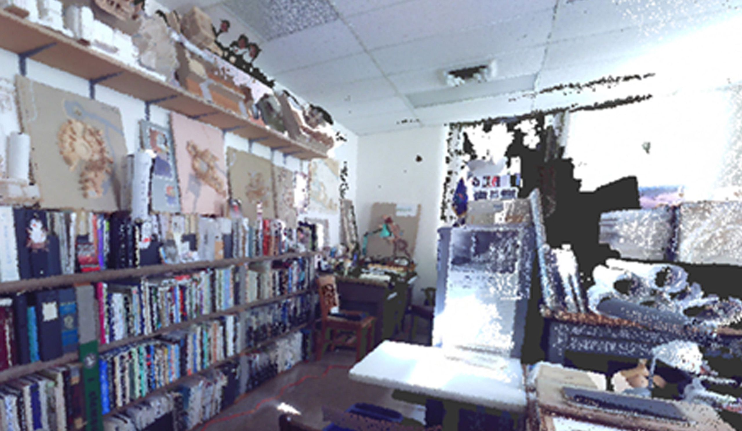
To begin our work, BNIM leveraged technology that has been around a while, but with new possibilities for integration: specifically, laser scanning and point clouds. For those who are unfamiliar or only have a vague sense of what this is, laser scanning is a lot like site surveying. In this case, we chose to partner with Brandon Walker with Midwestern Consulting. He provided our team with a full color, high density point cloud that was so clear, you could almost read the titles on the books in some of the offices. As amazing as this is, the process of creating this point cloud and leveraging it in a useful way poses several challenges in order to make it useful.

The actual technology of point cloud creation is not a new one. For over a decade we have had the ability to utilize laser scanners to produce point data sets. The issue was that making sense of this data took a large amount of time; in a black and white mass of points, it was difficult to distinguish objects from walls from doors. Until very recently, even with a good point cloud, they were barely useful beyond novelty. In most cases, a technician would have to convert the point cloud data into a CAD file, NURBS mesh, or other modeling data in order for it to be utilized to any extent. During the early years of point clouds, BNIM utilized this method of laser scanning and point cloud production to work on the Nelson Atkins Museum of Art façade.
Today however, the technology has come a long way. With the Seaton Hall project, we have been able to take advantage of Autodesk ReCap (short for reality capture). The benefits the program bring are tremendous. Once we received the point cloud data from our consultant, we were able to load that data directly into ReCap. After constructing the initial model off of the data, which takes a few hours depending on size, ReCap was able to cache the information and present it in a quick, nimble viewer that allowed us to explore and inspect the resolution of the point cloud. With this shortened workflow, we were able to take several high density scans and stitch them together, which allowed us to explore the entirety of Seaton Hall as well Mechanic’s Hall, the oldest building on campus, which is also being renovated for use with this project.

While in ReCap, we are able to move around in 3D and look through the different spaces that will be renovated. We have the ability to note structural locations, HVAC registers, and any other exposed systems. ReCap also allows us to make measurements of the space, so that we can get actual measurements without having to go out into the field. Like the technology before it, ReCap can export a mesh that then can be imported into most 3D modeling programs.
The biggest and most compelling feature of ReCap, as with most Autodesk products, is its ability to interact directly with Revit. By saving the point cloud to a ReCap project file, we have the ability to import the point cloud directly into Revit and place it on our existing model. With this, we can verify floor and ceiling heights, window locations, door locations, stairs, and all other existing pieces. This may seem like another safe guard to ensure accurate measures. However, with Mechanic’s Hall, ReCap was invaluable because with virtually no drawings detailing existing conditions, the team had no capability to model anything except for what could be captured with a tape measure. By utilizing ReCap, we were able to get accurate, reliable data on a building that would have otherwise been total guesswork. Moving forward, we will be able to anticipate and resolve conflicts on the site because our data is 100 percent as built.

Looking forward, point clouds and programs like ReCap will become key components of an architect’s repertoire. Renovation projects will become increasingly easier to manage, as the existing conditions can be gathered with 100 percent reliability. Even when a building is well documented, the effects of time and weather are hard to anticipate, and so our only recourse is to observe. Real world data will allow our buildings to become more accurate without the need for extensive time in the field on our hands and knees measuring. It will leave the architect free to explore the site in detail to focus on a solution to the project at hand. The accuracy will also allow the architect to exert their energy towards the design without the worry of facing RFI after RFI later in construction — and all because they began at the right point(s).
—
*The design team for the Seaton Hall Renovation is composed of BNIM, Ennead Architects LLP, El Dorado Inc. and Confluence Architecture