South Cedar Creek Connectivity Plan
Information
- Location Olathe, Kansas
- Completion 2013
- Services Landscape
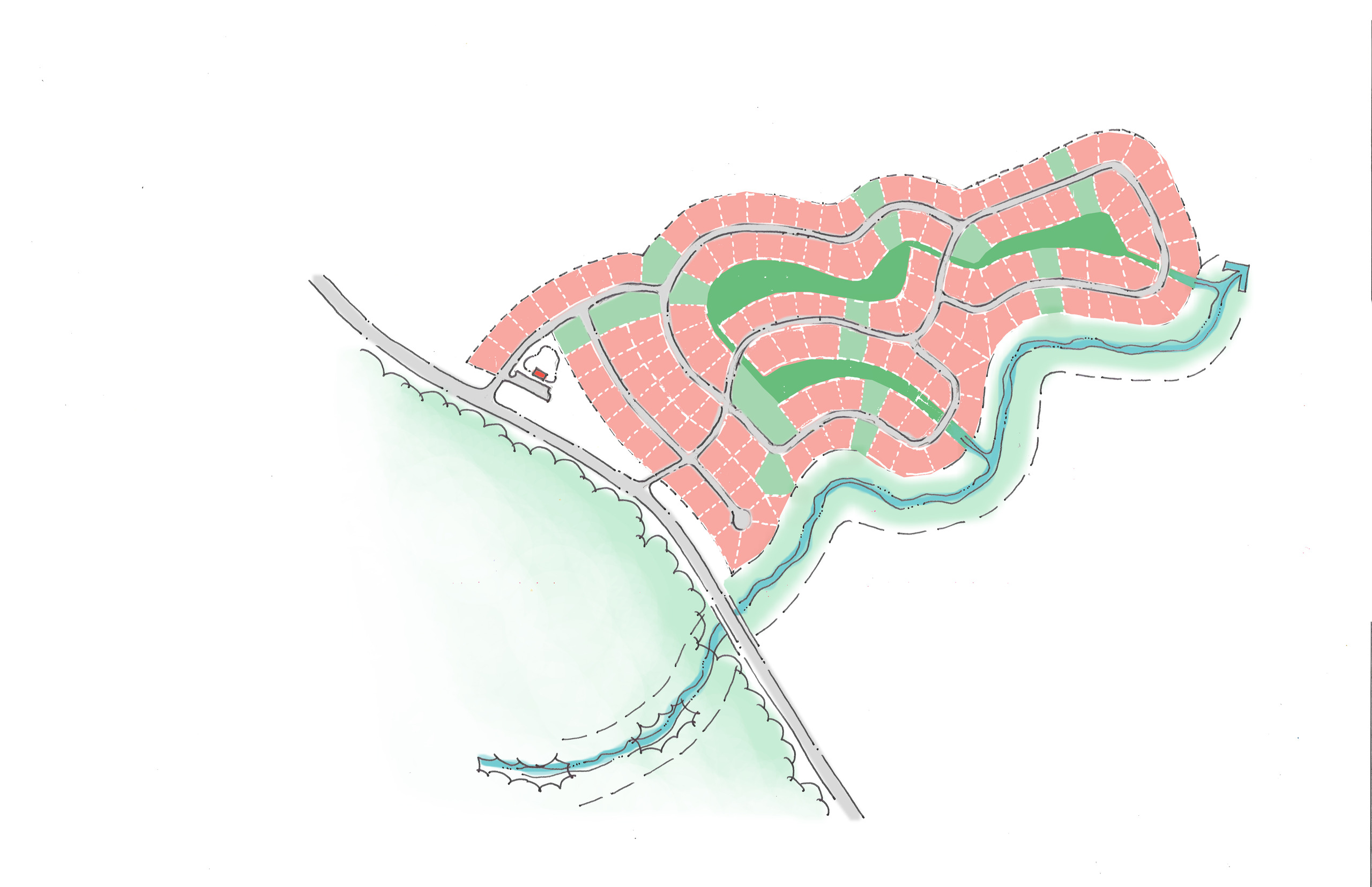
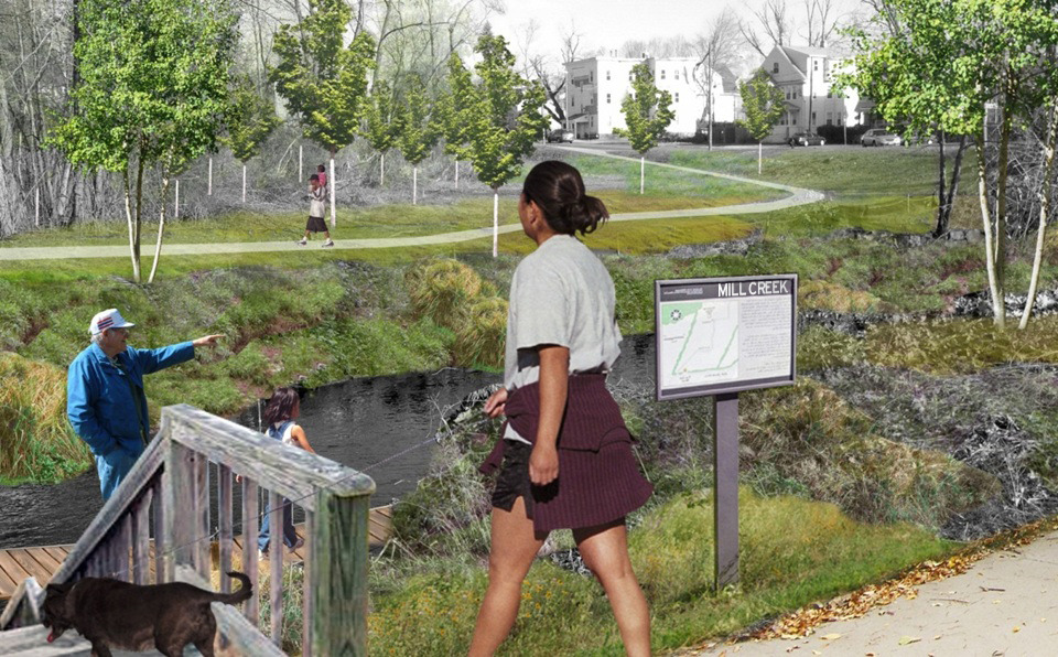
The Cedar Creek Watershed is a community treasure. Rolling hills, forests, and undisturbed streamways provide the watershed with unique natural capital and character worth preserving. The Cedar Creek Watershed is also unique in the potential it holds for the future of Olathe. City leaders understand the importance of attracting new residents and continuing to grow, in order to strengthen the City’s tax base, better utilize existing infrastructure investments, and position Olathe on a path to be vibrant, healthy, and competitive in the coming decades. This plan represents an opportunity to capitalize on the assets of the Cedar Creek Watershed to proactively connect the community together and define a better quality of life for Olathe’s current and future residents.
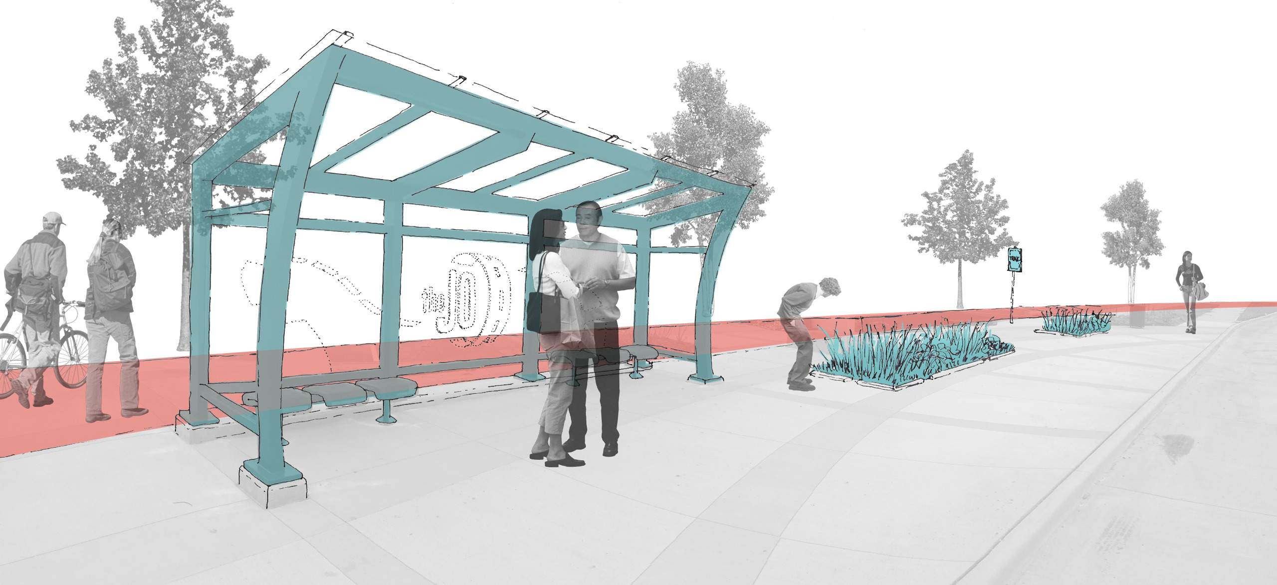
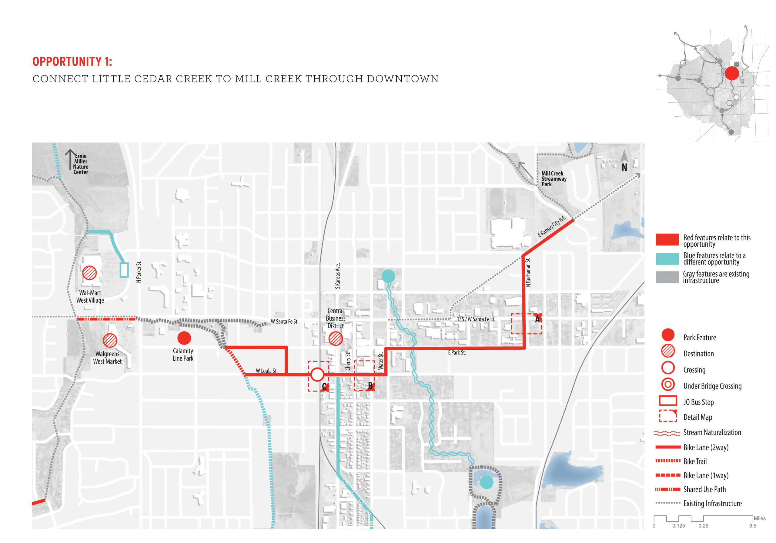
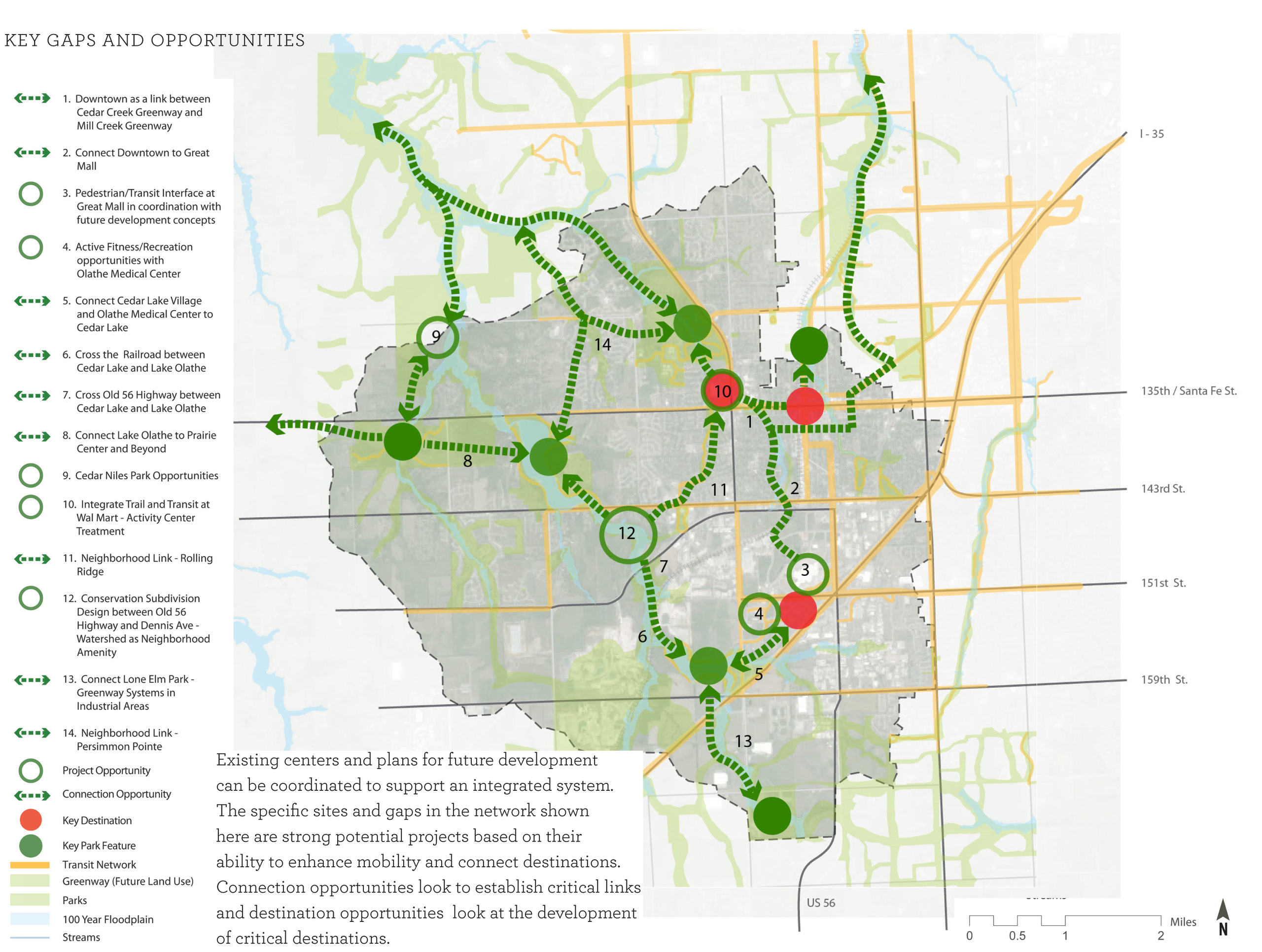
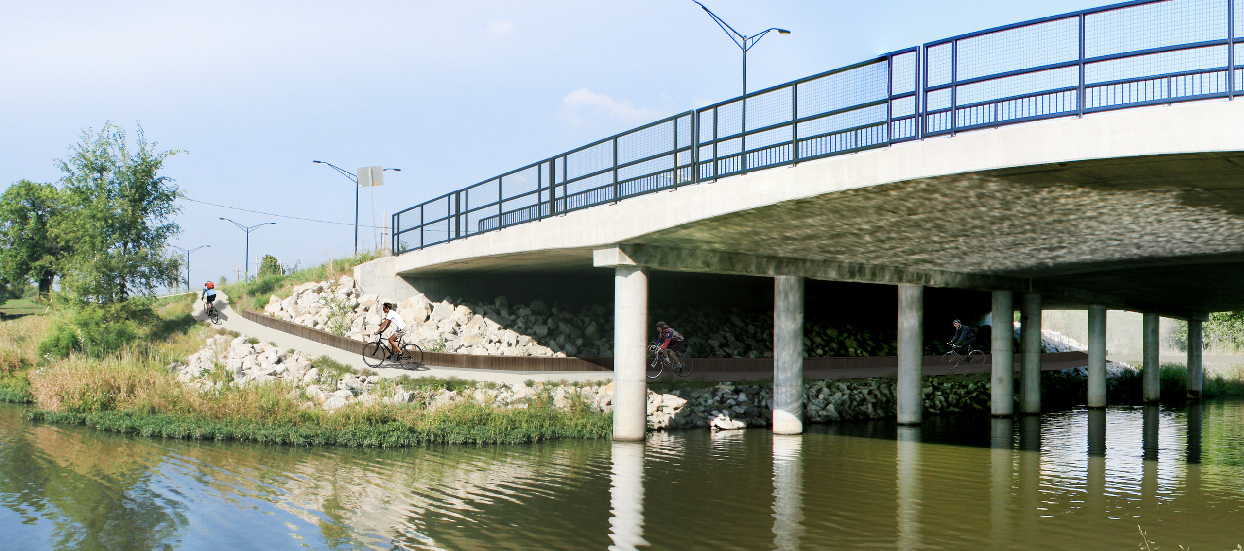
The South Cedar Creek Connectivity Plan envisions an integrated multi-modal transportation system connecting parks, residential, office, and industrial development with an improving pedestrian and bicycle network. The plan identifies key opportunities for connection between existing and planned activity and employment centers and begins the discussion about potential partnerships and funding sources to support these new development opportunities.
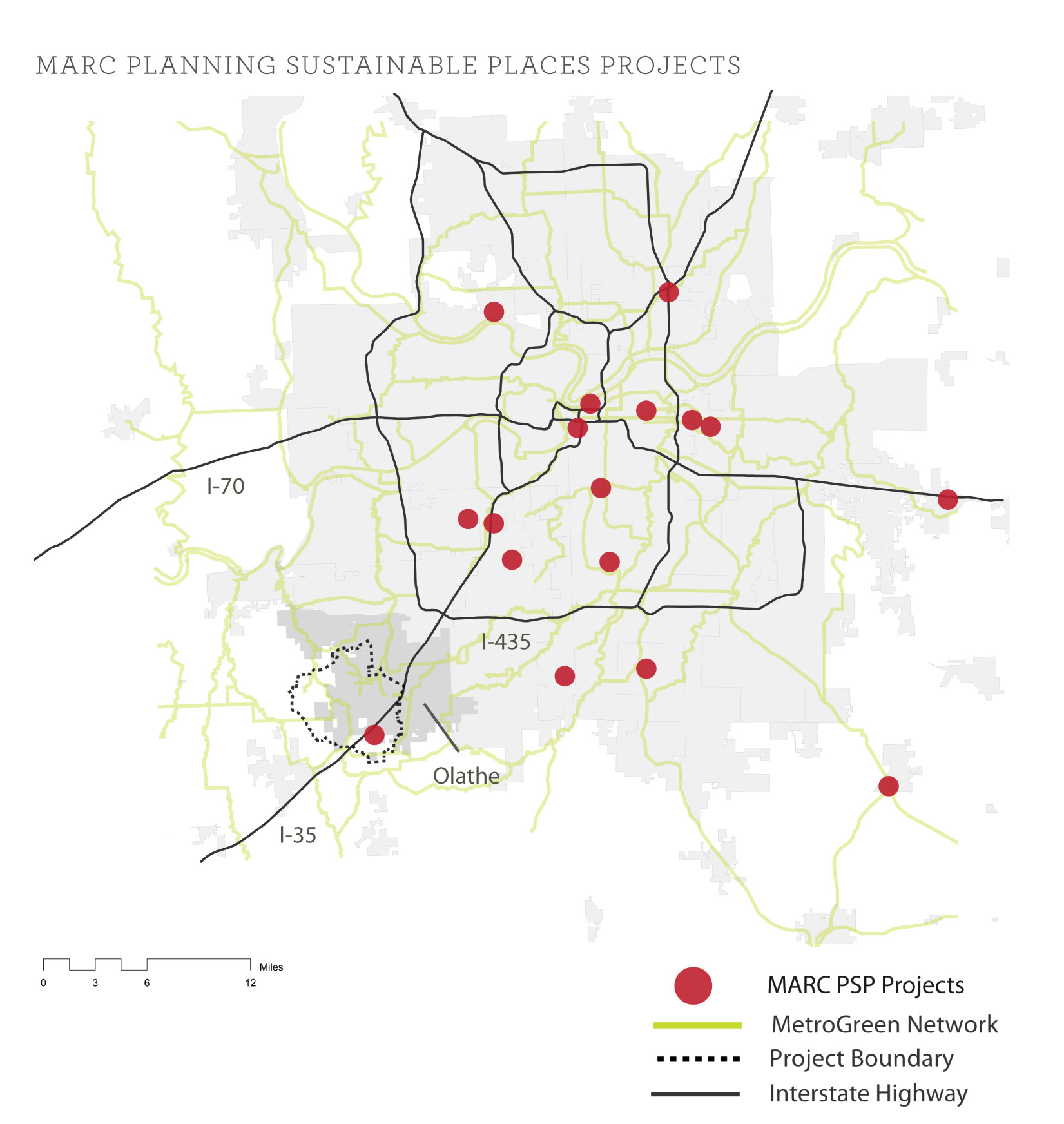
One of the roles of the plan is to connect the dots between existing assets and initiatives to leverage additional benefits. BNIM met with a variety of agencies and service providers to identify opportunities for collaboration and strategic coordination. Meetings with Johnson County Transit, Johnson County Parks and Recreation District, neighborhood groups, developers, Olathe Unified School District, property owners, and City staff/leadership were integral in developing a successful process and overall plan that responds to the community’s needs and aspirations. These ideas were developed in the document and distributed to major developers and owner’s of activity centers. Partnerships and other resources were identified.
People
Team
- Jim Schuessler
- Jihee Chung
- Phaedra Svec
- Thomas Morefield
Client
City of Olathe, Kansas
Awards
ASLA Central States
Merit Award
2015